Narragansett Bay and Local Applicability
Better Bay Alliance (BBA) | February 2026
Narragansett Bay Hazards
- Newport Harbor entrance/speed limit
- Fish Traps off Newport and in the Bay
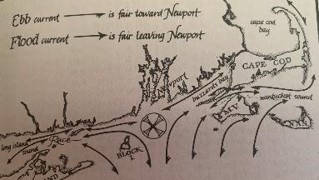
- Currents
Narragansett Bay Hazards
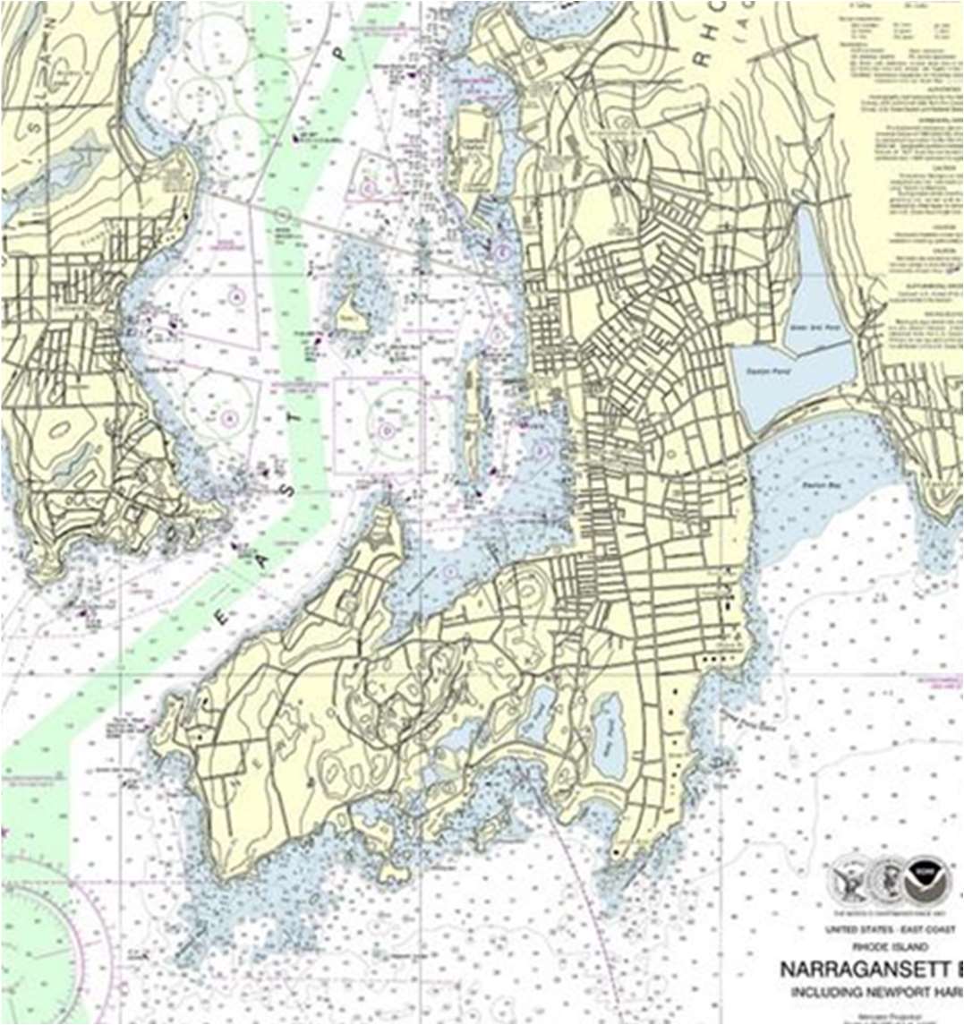
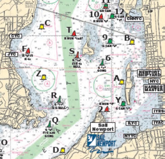
Newport Harbor Entrance
Things to note:
- Harbor entrance traffic
- Speed limit
- Anchorage area
- North of Rose Island
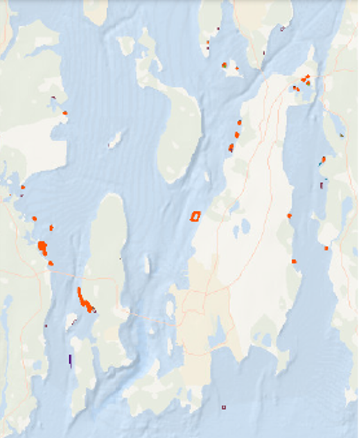
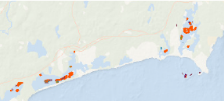
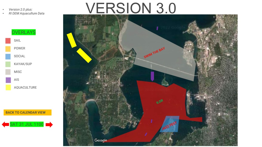
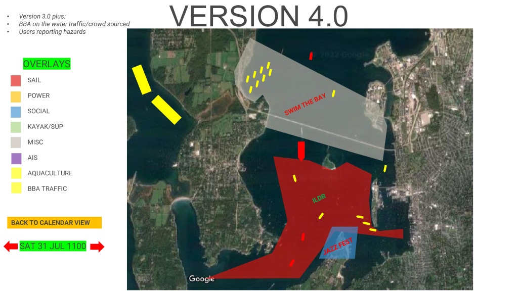
Fish Trap Areas
Things to note:
- Large areas authorized by DEM for fish traps in the bay and in southern RI waters
- Most traps in the bay are for aquaculture (oysters) and are poorly marked
- Traps can be barrels with cable between barrels just below waterline (offshore)
- Markings at edge of traps have buoys with flags, but are difficult to see, especially in heavy weather
- Several located around Narragansett Bay, and several located south of the bay offshore and in south county aquaculture farms
Narragansett Bay Hazards
Harbor Entrance
Things to note:
- Harbor entrance traffic
- Speed limit
- Anchorage area
- North of Rose Island
Fish Trap Areas
Things to note:
- Large areas authorized by DEM for fish traps in the bay and in southern RI waters
- DEM latest interactive permit map
- Most traps in the bay are for aquaculture (oysters) and are poorly marked
- Traps can be barrels with cable between barrels just below waterline (offshore)
- Markings at edge of traps have buoys with flags, but are difficult to see, especially in heavy weather
- Several located around Narragansett Bay, and several located south of the bay offshore and in south county aquaculture farms
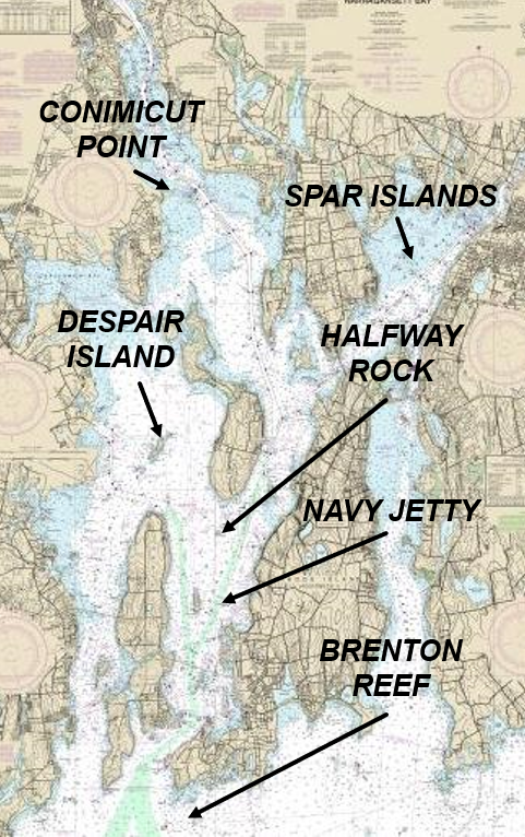
Other Narragansett Bay Hazards
Harbor Entrance
Things to note:
- Conimicut Point
- Despair Island
- Spar Islands
- Halfway Rock
- Navy Jetty
- Brenton Reef
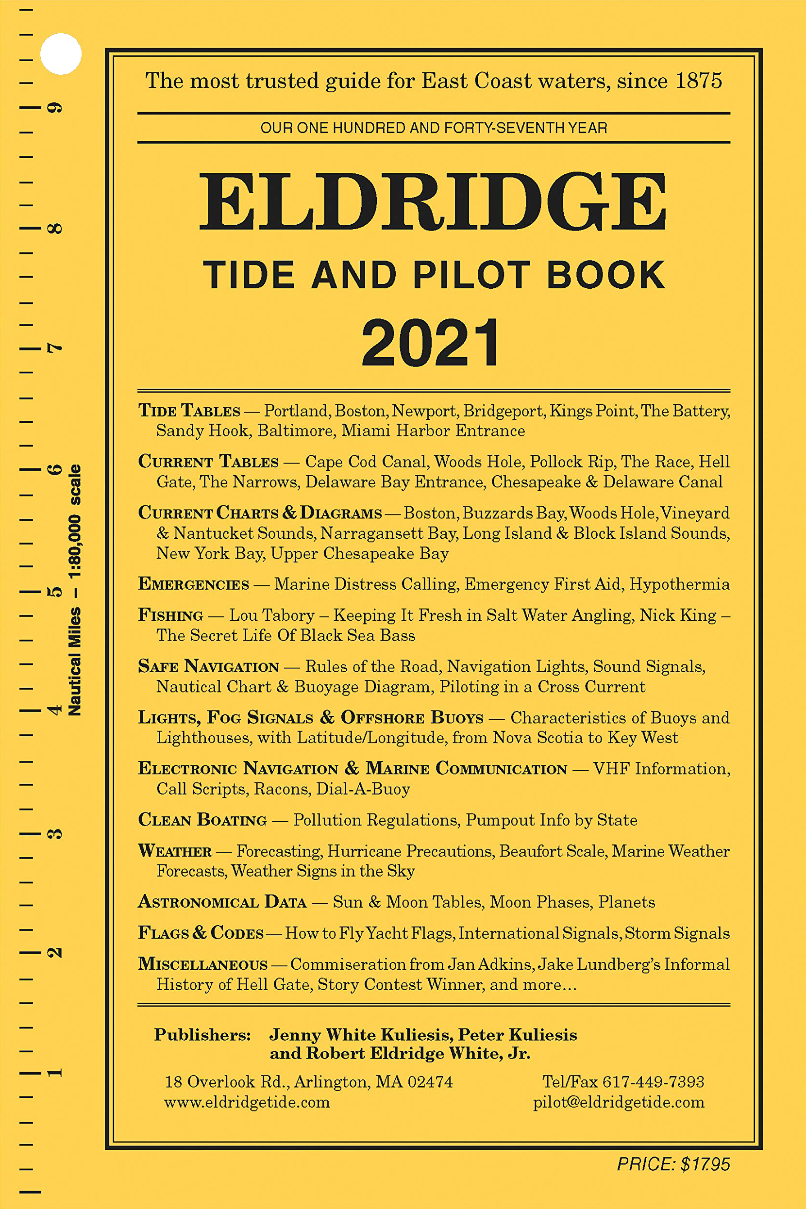
Eldridge Tide and Pilot Book
- Outstanding local resource of info on Narragansett Bay and beyond to much of east coast
- Tide Tables
- Current Tables and Diagrams
- Astronomical Data (sun/moon/planets)
- Safe Navigation
- Lights, Signals, and Buoys
- Communication protocols
- Flags & Codes
- Miscellaneous useful info
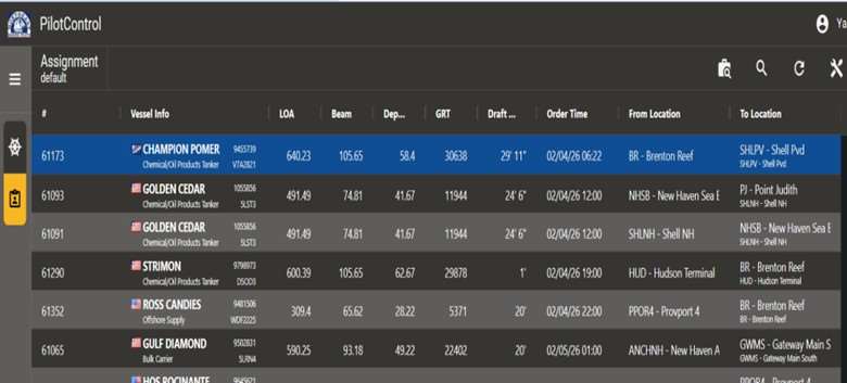
Northeast Pilots Traffic Info to local Racing YC’s
Through “summit” meetings held with the NE Pilots, tug operators, Yacht Clubs, DEM, and USCG stakeholders, the NE Pilots made available their data to the YC on major ship movements to/from Narragansett Bay
This greatly enhances the Race Committee’s ability to coordinate racing with known incoming/outgoing traffic
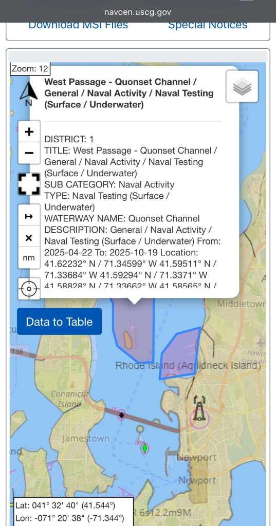
USCG Local Notices to Mariners
- USCG has switched to a digital form of their LNM:
- Found here: www.navcen.uscg.gov/msi
Examples of LNM info:
- Block Island Wind Farm WTG-3 Foghorn Structure Inoperable August 24, 2022
- NEBW Daybeacon 8- Structure Destroyed first reported June 23, 2021 Corrected March 2023
- Bristol Harbor Daybeacon 6A Daymark Missing first reported October 5, 2022
- Bristol Harbor East Channel Buoy 5 Off Station and a Hazard to Navigation first reported October 5, 2022 Corrected March 2023
- Bristol Harbor West Channel Buoy 1 Off Station first reported February 23, 2022
- Braga Bridge Sound Signal Inoperable as of January 11, 2023
- Quonset Point Terminal Approach Buoy EB-B Missing first reported July 29, 2022
- Pawcatuck River Channel Daybeacon 19 Missing first reported May 19, 2021
USCG Marine Event Permits and LNMs
› USCG has switched to a digital form of their LNM:
- Found here: www.navcen.uscg.gov/msi
- Much easier to read/digest in layers vs their original large text documents
Marine Event Permits (MEPs)
- All major events planned on the water require a MEP application submitted to the USCG
- The USCG MAY issue a permit (if security perimeter is required), but MAY NOT
- Whether a permit is issued or not, the USCG will use the data in the permit application to update their digital LNM data
Update 10/24/2022
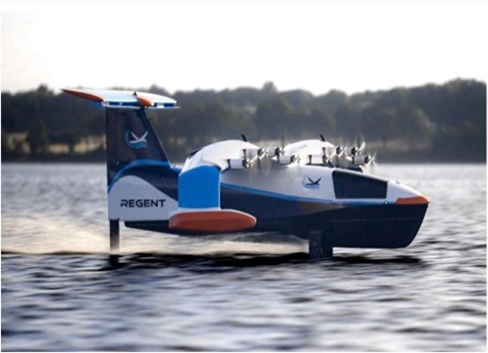
Regent Craft Inc. will be testing a prototype wing-in-ground-effect (WIG) craft in Narragansett Bay and Mt. Hope Bay from July 2022 until May 31, 2023. The testing areas include the waters of Narragansett Bay. East and West of Prudence Island Testing of the prototype will last approximately 2-4 hours, Monday through Friday with occasional tests on weekends and occur during the daylight hours only. All mariners are advised to use caution when transiting through these areas and avoid these areas if possible while testing is ongoing to deconflict traffic conditions. The vessel can be reached on VHF channels 13/16. For more information, please tact the USCG Sector Southeast New England at 508 457-3211
Continue your boating education
Many local resources exist for various levels of education on various boating topics
www.betterbayalliance.org has links to all these resources
Accidents and Avoidance
Recent Youth Tragedy in Florida
Summary
- A 17’ sailboat sank off Miami Beach’s Hibiscus Island in Biscayne Bay July 28, 2025, after a 60’ barge being pushed by a tugboat at just 3.5kts hit the sailboat
- Five children and a camp counselor were aboard the sailboat, part of a Miami Yacht Club summer camp
- Three children died
Details
- Sailboats typically have the right-of-way over engine-powered boats on the water, but there are exceptions
- A sailboat operator must give way to a vessel “restricted in her ability to maneuver”
- The sailboat should have avoided the tug/barge, AND the tugboat pushing the barge and the crew of the barge had the responsibility to avoid hitting the much smaller sailboat
- In addition to maintaining a proper speed in an area known to be popular with recreational boaters, the barge should have also had someone operating as a lookout for anything in its way
Accidents and Avoidance #2: A Disaster Averted by Luck
Summary
- On a sunny afternoon with light winds and unlimited visibility just north of the Newport bridge, one of RI’s worst marine accidents was averted by just seconds and amazing luck
- A Shields 30’ sailboat skippered by one of RI’s best racing sailors (along with eight other Shields) had just started a race
- Meanwhile, a 30’ powerboat with a skipper, several children, and two other adults was planing towards the Shields fleet at about 25 kts
- The Shields in question was about to tack when the skipper first saw and heard the planning powerboat estimated at about 50 feet away and heading at the sailboat
- With no time to react, the sailing skipper assumed the worst, but by luck the speed delta caused the powerboat to almost pass just in front of the Shields
- However, they collided, sheering the bow off the Shields and putting a hole in the powerboat
- Only then did the powerboat slow down and it never altered its course
- By total luck, no one was injured and both the Shields and the powerboat were towed to shore
- But for a couple of seconds, the powerboat could have hit the Shields amidships, likely resulting in multiple injuries at best and many deaths at worst
Conclusion
- Three major mistakes were made by the powerboat captain:
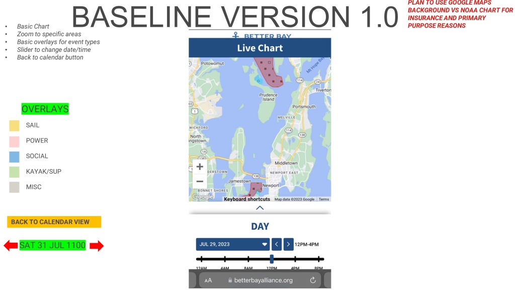
- If the captain had consulted LiveChart, he may have known the location of the Shield’s regatta and may have gone around it
- Given the size and obviousness of nine Shields all together and the fact that there was no course change by the powerboat, indicates there was no one looking forward
- The scenario indicates that it was likely the captain of the powerboat, which must always give way to sailboats, had his autohelm on which should never be used in any sort of boat traffic
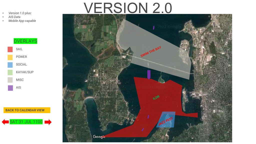
LIVE CHART Overview
LiveChart 2025 Summary
- Total of ~400 events for 2025 season
- ~100 “events” that are 1-5 days in duration
- ~260 weeknight sailboat racing “series” events
- Sailing is by far the most frequent organized type of events on our RI waters
- Categories include Sail/Power/Social/Paddle/Misc
- Example events include:
- All major sailing regattas on weekends/weeknights
- 30+ cruise ship visits
- NUWC Navy range testing MON-FRI 0730-1600
- Jazz/Folk festivals, Fireworks, Poker Run, Aquapalooza
- Save the Bay Swim, Dutch Harbor Swim, Ocean State (paddle) Crossing
- Example events include:
- Conflicts Resolution
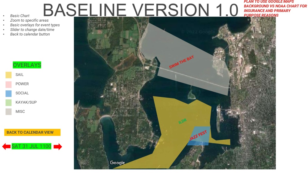
- Multiple dates yielded events overlap in date/time/area that became visible once database was loaded
- BBA volunteers worked to communicate with event authorities to resolve
- BBA plans to educate more event organizers on using LiveChart as a tool to plan/deconflict water space management issues
